


Table of Contents
The gaming community was jolted into high gear this morning after a physical GTA 6 map leak surfaced across social media, revealing the full geographic layout and administrative county borders of the State of Leonida ahead of launch.
First reported by Insider Gaming, the unauthorized photograph allegedly originated from retail promotional packaging in the United Kingdom, providing players with their most comprehensive look yet at the sprawling open-world environment.
| Cartographic Dimension | Physical Collector’s Edition Map | In-Game Satellite Mini-Map GPS | Grand Theft Auto V Blueprint Baseline | Open-World Cartography Purpose |
|---|---|---|---|---|
| Cartographic Style | Retro tourist souvenir illustration with county borders | Dynamic high-contrast vector radar overlay | Monochrome blueprint architectural paper | Stylized physical collectible for physical box buyers |
| Geographic Boundaries | Entire State of Leonida from north ridge to southern keys | Active localized render bubble with fog of war | Los Santos metropolitan basin and Blaine County | Establishes full state territorial borders and coastlines |
| Administrative Districts | Distinct county divisions labeled with cultural motifs | Street-level neighborhood districts and postal blocks | Single city jurisdiction and rural county divide | Delineates police jurisdictions and municipal zones |
| Key Landmark Markers | Clipart icons denoting monster trucks, UFOs, and wildlife | Real-time mission waypoints and active safehouses | Concealed UV blacklight markings and landmark notes | Guides exploratory free-roam travel without screen clutter |
| Arterial Transit Corridors | Exaggerated interstate highway loops and overseas bridges | Dynamic GPS navigation ribbons with traffic alerts | Dual highway ring circuits around Mount Chiliad | Highlights primary high-speed transit loops across counties |
| Distribution Point | United Kingdom retail takeover packaging leak | Direct game engine rendering on consoles | Global retail disc packaging inclusions | Physical memorabilia accompanying deluxe physical editions |
Origin and Verification: How the GTA 6 Map Leak Surfaced
The unexpected emergence of the GTA 6 map leak demonstrates how physical retail logistics remain the most vulnerable vector for video game security during the final countdown to commercial deployment.
Unfolding across Reddit and X, the initial photograph showcased an authentic folded paper document depicting the entirety of Leonida, complete with colorful vintage illustrations reminiscent of classic mid-century tourist brochures.
Industry sources suggest the leak originated from an employee involved in a major GTA 6 marketing takeover at the prestigious Selfridges department store in London, where exclusive promotional assets were recently delivered.
Unlike speculative mockups produced by digital artists, this GTA 6 map leak carries distinctive production hallmarks, including authentic folds, precise printing registration marks, and typography that aligns perfectly with official studio branding.
While publishers at Rockstar Games have historically enforced strict secrecy agreements, high-profile physical merchandise inherently passes through hundreds of third-party distribution hands prior to worldwide customer deliveries.
Stylized Souvenir Cartography: Clipart Landmarks and Retro Visual Language
A closer inspection of the GTA 6 map leak highlights a deliberate stylistic shift away from technical satellite imagery in favor of nostalgic, character-driven souvenir cartography celebrating Florida culture.
The printed map is adorned with whimsical clipart illustrations scattered across diverse regions, showcasing iconic symbols including monster trucks, coastal sea turtles, passenger airliners, and even a mysterious UFO hover marker.
In one notable illustration, an alligator is humorously depicted swinging a golf club, capturing the irreverent satire that has defined the series while poking fun at luxury country clubs across modern Florida.
This retro aesthetic strongly evokes the iconic fold-out tourist maps included with physical copies of Grand Theft Auto Vice City and San Andreas, rewarding long-time franchise enthusiasts who appreciate physical tangible collectibles.
By integrating stylized iconography rather than precise street grids, the GTA 6 map leak offers players a delightful thematic travel guide that encourages organic exploration rather than rote objective-marker navigation.
Leonida Regional Geography: From Northern Highlands to Southern Archipelagos
Geographically, the GTA 6 map leak confirms that Leonida is far more diverse than simply a digital recreation of Miami, stretching across multiple distinct climatic biomes and geological formations.
At the northern frontier, rolling hills and dense pine forests establish a rugged wilderness zone that offers challenging off-road terrain, steep mountain ridges, and secluded rural communities far removed from coastal civilization.
These newly exposed boundaries build directly upon earlier discoveries detailed in our analysis of GTA 6 map locations revealed in store displays, corroborating seven previously rumored regional territories.
To the south, the map illustrates the expansive Grassrivers marshland, characterized by intricate waterways and sawgrass swamps that seamlessly transition into an idyllic chain of tropical barrier islands linked by overseas bridges.
Central Leonida appears dominated by industrial agriculture and massive inland freshwater basins, ensuring the GTA 6 map leak represents an entire functioning virtual ecosystem featuring dramatically varied weather patterns and environmental lighting.
Scale and Highway Architecture: Comparing Leonida to Historical Benchmarks
When evaluating physical dimensions, the GTA 6 map leak provides critical insights into how Rockstar designed high-speed vehicular travel across its vast open-world infrastructure.
A massive multi-lane interstate highway system loops around the continental landmass, connecting metropolitan Vice City to western industrial shipping ports and northern forest outposts without forcing motorists through congested urban centers.
Infrastructural landmarks such as toll plazas, suspension bridges, and elevated viaducts are clearly demarcated, indicating that vehicular movement and high-speed pursuits will feel remarkably fluid across varied regional counties.
| Leonida Administrative District | Real-World Geographic Counterpart | Primary Biome & Topography | Key Illustrated Landmarks & Easter Eggs | Transit Connectivity & Infrastructure |
|---|---|---|---|---|
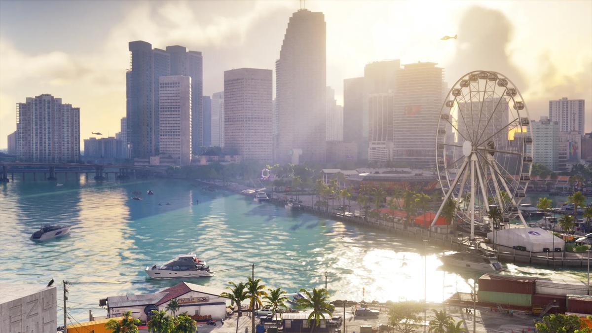
| Vice City Metropolitan | Miami-Dade County | Urban sprawl, coastal beaches, and canal waterways | Downtown skyscraper skyline, luxury marinas, and golf resorts | Multi-lane arterial freeways and elevated light rail |
| Grassrivers Basin | Florida Everglades | Expansive marshland, mangroves, and sawgrass swamps | Airboat launches, wildlife sanctuaries, and alligator motifs | Elevated scenic causeways and unpaved dirt trails |
| Leonard County & Keys | Florida Keys & Key West | Chain of tropical barrier islands and shallow coral reefs | Deep-water boat marinas, seaside bars, and drawbridges | Extended Overseas Highway causeway linking islands |
| Ambrosia Agricultural Belt | Central Florida & Lake Okeechobee | Freshwater lakes, citrus groves, and industrial farms | Fertilizer processing plants and agricultural silos | Two-lane commercial shipping highways and freight rail |
| Northern Forest Ridges | Ocala National Forest & Panhandle | Rolling hills, dense pine woods, and river canyons | Off-road mud tracks, monster truck parks, and secluded airstrips | Winding alpine bypass routes and logging tracks |
| Port Gelhorn & Gulf Coast | Tampa Bay & Gulf Coast | Commercial shipping bays, refineries, and suburbs | Industrial container docks, warehouses, and fuel refineries | Interstate junction hubs and coastal shipping lanes |
Rendering such massive open-world scale at seamless 60 frames per second will heavily tax modern gaming silicon, much like the enthusiast hardware profiled in our AMD Ryzen 7 9800X3D gaming CPU performance benchmark.
Simultaneously, seamless streaming across vast digital terrains reflects network infrastructure demands similar to those observed in our review of Xbox Cloud Gaming bandwidth requirements for modern living rooms.
The Community Mapping Project: Reconciling Trailer Telemetry With Leaked Prints
For several years, dedicated community cartographers have painstakingly assembled digital coordinate models, and this recent GTA 6 map leak provides tangible confirmation for hundreds of predicted landmarks.
Enthusiasts are already utilizing advanced AI upscaling algorithms to enhance the blurry photograph, cross-referencing road curvature and coastal outlines against real-world satellite scans of southern Florida.
Early cartographic comparisons reveal that while the collector poster uses stylized artistic license, the macro geometry matches trailer camera angles, confirming the legitimacy of this GTA 6 map leak.
Crucially, the physical print corroborates earlier speculation that Leonida spans nearly two and a half times the landmass of Los Santos, offering players an immense playground for sandbox mayhem.
As digital analysts continue refining their composite coordinate overlays, this GTA 6 map leak serves as the foundational Rosetta Stone that unites years of speculative community research into one coherent layout.
Frequently Asked Questions
Where did the physical GTA 6 map leak originate?
The GTA 6 map leak reportedly originated from promotional material inside the Collector’s Edition at a United Kingdom retail promotion, where an employee captured unauthorized photographs of the printed paper poster.
Is the leaked physical map identical to the in-game radar map?
No, the physical print featured in the GTA 6 map leak is a stylized tourist souvenir map adorned with retro clipart illustrations, rather than a technical topographical satellite radar display.
What major regions are confirmed by the leaked map?
The leaked poster confirms several prominent administrative regions across Leonida, including metropolitan Vice City, the Grassrivers wetland swamp, the southern island keys, northern pine forests, and western industrial port facilities.
How large is the Leonida map compared to Grand Theft Auto V?
Cartographic analysis of the GTA 6 map leak indicates that the state of Leonida encompasses roughly twice the physical landmass of Los Santos, offering significantly larger wilderness areas and extensive island chains.
Does the map confirm easter eggs like UFOs and monsters?
Yes, the physical poster features playful clipart markers including a flying saucer icon, monster trucks, and diverse wildlife, hinting at classic open-world mysteries scattered throughout remote rural counties.
Final Verdict: Physical Nostalgia Meets Next-Generation Open-World Scale
The unexpected emergence of the GTA 6 map leak underscores the immense global anticipation surrounding Grand Theft Auto VI, delivering concrete geographic confirmation while preserving the excitement of discovery.
By adopting a colorful mid-century tourist brochure aesthetic for its physical edition, Rockstar honors franchise heritage while giving physical edition collectors a treasured keepsake to display on bedroom walls.
As enthusiasts spend the remaining weeks dissecting every illustrated landmark and highway junction, the GTA 6 map leak cements Leonida as the most ambitious virtual sandbox ever conceived for modern gaming hardware.
